Slovakia facts

LONG (HI)STORY IN SHORT:
Location: Central Europe, below Poland
Name of the country: Slovak Republic (Slovakia)
Form of government: Parliamentary democracy
Independence declared: 1st January 1993 (from Czechoslovakia)
Population: 5.4 milion
Land area: 49,035 km2
Capital: Bratislava
Administration: 8 self governing regions called Higher Territorial Units
Currency: 1 € (euro) = 100 cents (from 2009)
Neighbouring countries: Czech republic, Poland, Ukraine, Hungray, Austria
Land boundaries: 1611km
The longest boundary: 627 km with Hungary
The shortest boundary: 97 km with Ukraine
The biggest city: Bratislava
Other big cities: Kosice, Presov, Zilina, Banska Bystrica, Trnava, Nitra
Official language: Slovak
Main international airports: Bratislava, Kosice, Poprad
Main port: Bratislava (on the river of Danube)
Time zone: GMT +01.00 Summer time / Daylight saving: Yes
Religion: mainly roman – catholic (62%)
Ethnicity: 81% Slovaks, 8,5% Hungarians, 2% Roma,
Membership: Member of Schengen area, EU and NATO (from May 2004)
International phone prefix: +421
Emergency number: 112
Transportation: land lock country, but you can get here by car, flight, train, bus.
Electricity: 220 V/50 Hz, two-pole socket with safety pin
Number of public holidays in Slovakia: 15
Credit / debit cards: widely accepted, but ask first.
Fuels: Unleaded and leaded fuels with 91, 95 and 98 octane, as well as diesel fuel
Driving side: right side of the road
Alcohol tolerance: 0 (zero) alcohol tolerance. Driving under the influence of ANY alcohol is a crime under Slovak law.
Highest speed limit: 130 km/h (68 miles/hour) on the motorways / highways
Traffic law: You must use seatbelts and headlights at all times. Using a cellular phones while driving is not legal.
Weather: four seasons — winter, spring, summer, autumn
Climate: temperate; cool summers; cold, cloudy, humid winters
Famous local alcohol drink: Slivovica (distilled from plums)
National cuisine: halushky
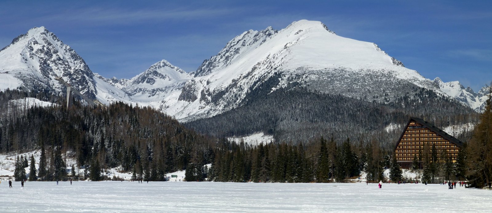
National parks: 9 National parks – Vysoke Tatry (High Tatras), Nizke Tatry (Low Tatras), Mala Fatra, Velka Fatra, Muranska planina, Poloniny, Slovensky kras, Slovensky raj, Pieniny.
Highest peak: Gerlachovsky stit 2655m in High Tatras
The lowest place: 94m in the River of Bodrog
Biggest lake: Velke Hincovo jazero in High Tatras
Biggest volcanic lake: Morske oko (The Sea Eye)
The longest river: Vah
The biggest cave complex: Demanovska jaskyna in Low Tatras
Largest castle complex: Spis castle
The highest church tower: 82m in the curch located in Spiska Nova Ves
Wooden churches: about 300 across the Slovakia
Towns worth to visit in the Eastern Part: Kosice, Presov, Bardejov, Stara Lubovna, Levoca, Spiska Nova Ves, Kezmarok, Svidnik, Michalovce
UNESCO heritage: Slovakia has cultural and natural properties inscribed on the UNESCO list
What is worth to see & discover: castles, caves, lakes & rivers, national parks, museums, ski resorts, spa resorts, religious history or UNESCO sights.